Real-Time Conditions
Alert Wildfire Web Camera (Eastern slope of the White Mountains)
Alert California Web Camera (from Silver Canyon)
Local Road Conditions
Travel Information
Bus service on Eastern Sierra Transit may be available from Los Angeles, to the south, and from Reno to the north. The nearest major airports are in Reno, NV, Las Vegas, NV, and Los Angeles, CA.
There are small airports in the towns of Mammoth Lakes, Ridgecrest, and Bishop. Seasonal commercial flights are available to the Bishop Airport (BIH) through United Airlines. BIH is 3 miles from OVS.
Bishop has 2 Enterprise Rent-A-Car locations, vehicle availability is often limited.
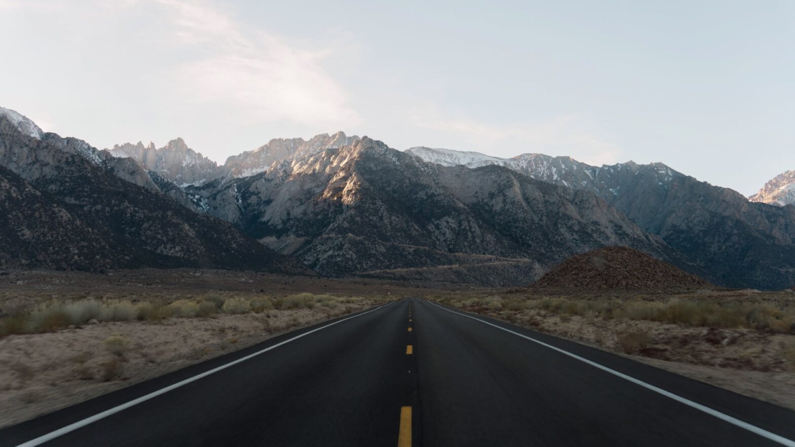
Highways crossing the Sierra Nevada, for example, Route 120 over Tioga Pass from Yosemite, are usually closed in winter/spring, and US Highway 395 may experience winter snow conditions north of Bishop.
Driving to Owens Valley Station From Bishop. The street address of the OVS is 3000 E. Line Street. From Main Street in Bishop (US 395) turn east on Line St. and drive for almost 6 km (note that the street name changes to Poleta Rd.). Shortly after crossing the Owens River bridge, the OVS will be visible on the south side of the road.
Approximate driving times to WMRC Owens Valley Station (OVS) from the nearest airports are:
- Bishop: 5 minutes
- Mammoth Lakes: 45 minutes
- Inyokern: 3 hours
- Reno: 4 hours
- Las Vegas: 4.5 hours
- Los Angeles International: 5 hours
- Los Angeles Ontario: 5 hours
Driving directions to upper stations
From California:
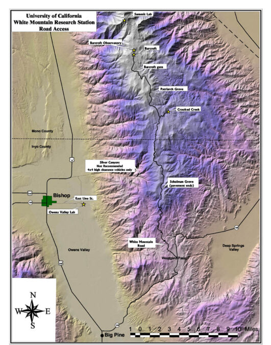
Access to Owens Valley from both northern and southern California is via US Highway 395. At the junction of Highway 395 and California Highway 168 at Big Pine, drive east on Highway 168 into the White Mountains. About 21 km from 395 at Westgard Pass, turn north (left) onto the White Mountain Road and follow the instructions below for the station you wish to visit. The White Mountain Road is paved and its intersection with Highway 168 is marked with a sign. DO NOT take Silver Canyon Road to White Mountain Rd., DO NOT listen to Google Maps. This road is steep and requires experienced 4X4 drivers.
From Nevada:
Approach California Highway 168 from the Oasis junction at the south end of Fishlake Valley. Drive west on 168 over Gilbert Pass, through Deep Springs Valley, and up Westgard Pass to the intersection of 168 with White Mountain Road. A sign marks this intersection. Turn north on White Mountain Road and follow the instructions below for the station you wish to visit. The White Mountain Road is paved and its intersection with Highway 168 is marked with a sign.
Once on White Mountain Road, drive north for about 16 km on pavement (see area map):
Crooked Creek Station At Schulman Grove, about 16 km from Highway 168, the pavement ends. Continue north another 16 km until the junction with the road to Crooked Creek. This junction is marked with a sign. Turn right and drive 1 km east on this road to the Crooked Creek station.
Distance from Owens Valley Station (Bishop) to Crooked Creek = 88 km (55 miles); driving time ~ 1.5 hours
Driving to Barcroft Station Before leaving for Barcroft Station be sure to contact the WMRC office in Bishop to arrange to have the locked Barcroft gate (two miles south of Barcroft) opened. Follow the instructions above for driving to Crooked Creek Station. At the intersection of the White Mountain Road and the Crooked Creek road, continue north on the White Mountain Road. Drive 11 km to the locked gate. Locking the gate behind you, proceed 3 km to the Barcroft Station.
Driving to the Barcroft Observatory Dome This facility is only accessible by a steep rugged road, and researchers must obtain permission from station personnel before driving to the dome.
Distance from Owens Station (Bishop) to Barcroft = 104 km (65 miles); driving time ~ 2 hours
Driving to the Summit Laboratory Transportation must be arranged and approved by the WMRC Operations Manager. Authorized WMRC vehicles are only permitted unless noted. Note that snow usually blocks the road 400 m below the summit lab.
DISCLAIMER. WMRC high-altitude facilities are located at altitudes above 3,000 m (see area map) along the White Mountain Road. The road is usually clear of snow between late June and November. Please consider:
- Discomfort and altitude sickness can happen to anyone, regardless of age or physical condition. If you have questions or concerns about your reaction to high-altitude environments, please consult your physician before driving to Barcroft or Crooked Creek Stations.
- There are no services or communications facilities after leaving Big Pine.
- If you are a WMRC researcher, please visit or call the Owens Valley Lab to relay your travel plans before attempting to drive to Crooked Creek or Barcroft Station.
- White Mountain Road north of Schulman Grove is unpaved. Portions are rocky and have washboards — Keeping driving speeds below 40 km/h (25 mph) reduces the likelihood of flat tires.
- Although WMRC recommends the use of high-clearance vehicles, when the road is open, standard passenger cars can usually negotiate it without difficulty.
- For current information about the status of the White Mountain Road, please call Inyo National Forest at 760-873-2500.